

GIS STUDENTS HELP MAP ANCIENT TRAIL AT HAWAI‘I COMMUNITY COLLEGE – PĀLAMANUI
Hawai‘i Community College students who are studying global positioning systems (GPS) and geographic information systems (GIS) recently used their technology skills to help preserve part of an ancient Native Hawaiian trail.
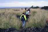
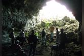
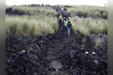
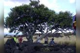
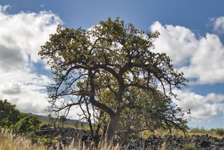
The trail — which features petroglyphs, caves, and ancient lama trees — is next to the new Hawai‘i Community College – Pālamanui campus in Kona. Until recently the trail was overgrown with invasive fountain grass and forgotten.
Since June 2014, trail expert and Hawai‘i CC – Pālamanui humanities lecturer Dr. Richard Stevens has been leading an effort to restore the mauka-to-makai pathway. Many students and community volunteers have ripped out fountain grass and moved rocks to help reclaim the trail from nature.
Now the goal is to keep track of the trail, and that’s where the students enrolled in Introduction to GIS and GPS come in.
“The class's work is hugely important,” said Stevens. “The trail won't be lost again: It's carved into cyberspace.”
“It’s a great learning tool, being out there, tying the information together, and accurately describing what you saw,” said Chow.
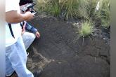
On a hot Saturday morning on November 14, 2015, the Hawai‘i CC students used their handheld GPS devices to mark significant locations along the trail, including the petroglyphs and caves.
“Now we’re going to take that data and put it into a GIS map and basically create a base map of the trail and all the significant locations,” said Victor Rasgado, a geomatics lecturer at Hawai‘i CC. “So we’re preserving that trail, and we’re doing it with new technologies.”
The Introduction to GIS and GPS course is one of four classes Hawai‘i CC students take in order to earn a certificate in Geospatial Technology. The courses and the certificate are part of the Architectural, Engineering and CAD Technologies program at Hawai‘i CC, which offers three certificates and an Associate in Applied Science degree.
Sterling Chow, one of the students in the class, said he and his classmates gathered GPS data, took detailed notes, and snapped pictures in order to compile enough information to create a map.
“It’s a great learning tool, being out there, tying the information together, and accurately describing what you saw,” said Chow.
Another student, Jun Haruki, said the “trail experience was very interesting, and it is nice to have something that is so close to campus. They have done a terrific job of restoring the trail. Not everyone has a chance to experience such a wonderful excursion.”
The trail is on land owned by Pālamanui, LLC, which is the private development company planning a mixed-use community next to the campus. Preservation of the trail is part of the company’s cultural resource management plan.
The GIS and GPS class’s excursion is just the latest example of college faculty using the trail as a classroom. Stevens has taken his writing and history students there, and the Hawai‘i CC – Pālamanui campus has plans to continue using it as an educational resource.
"Trails are cultural treasures, living artifacts showing the ingenuity and survivability of the ancient Hawaiians in nature,” said Stevens. “Recording those treasures on maps helps us not lose the lessons they have to teach us."


